
Driving across the plain between Murcia and the Mar Menor, you can see it from afar: a solitary, rocky mountain rising between the fields and greenhouses. That is Cabezo Gordo. A place for hiking and cycling, with wide views over the Campo de Cartagena, and at the same time one of the most important Neanderthal sites in Spain: the Sima de las Palomas.
We explored Cabezo Gordo ourselves, by mountain bike. In this article you can read what makes Cabezo Gordo so special, what has been found in the Sima de las Palomas, how you can hike and cycle there, and what else there is to do in the area.
Where is Cabezo Gordo?
Cabezo Gordo lies in the municipality of Torre-Pacheco, in the Murcia region. The mountain rises in the middle of the flat coastal depression of the Campo de Cartagena, inland from the Mar Menor. According to Turismo Región de Murcia, Cabezo Gordo is 312 metres high and around 3 kilometres long. Because the land around it is so flat, it stands out from far and wide.
Villages such as Balsicas and Roldán also belong to the same municipality of Torre-Pacheco. Cabezo Gordo is not on the coast: the Mar Menor and towns such as Lo Pagán, Santiago de la Ribera and Los Alcázares lie further east. From the mountain, however, you can look out over them.
Why does Cabezo Gordo stand out so much?
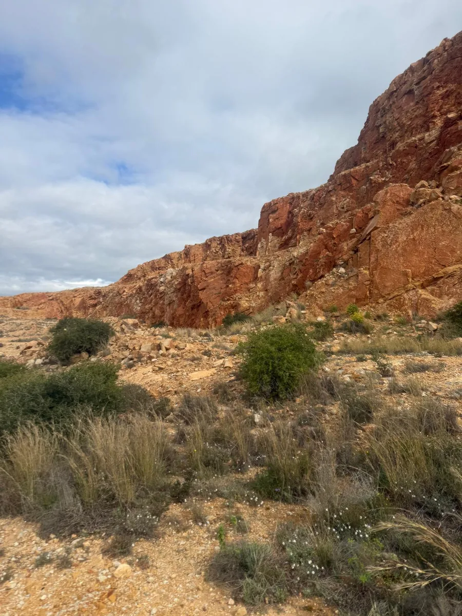
Cabezo Gordo consists of limestone and marble. According to Turismo Región de Murcia, the mountain was formed in the Triassic, around 250 million years ago, and geologically belongs to the Betic Cordillera. This sets it apart from the volcanic islands in the Mar Menor.
The mountain is a protected natural area. Since 1998, Cabezo Gordo has had the status of Paisaje Protegido (protected landscape). The area is also designated as a Natura 2000 site (LIC), as a Lugar de Interés Geológico and as a protection area for wild fauna. Turismo Región de Murcia mentions, among others, the ocellated lizard and more than 70 bird species, including kestrels.
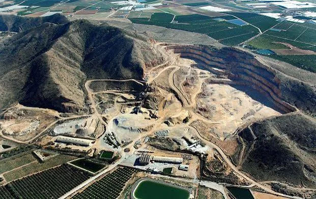
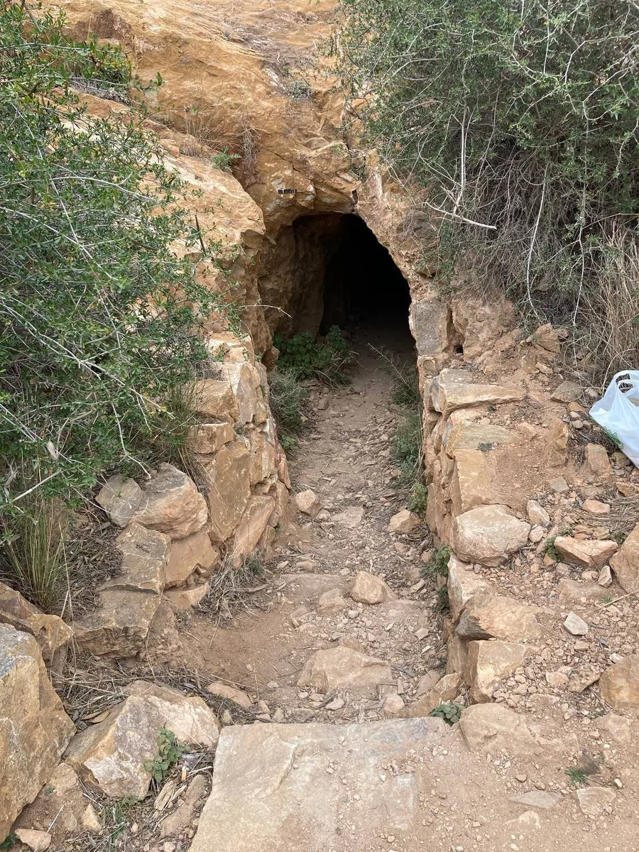
People have left their mark too. In the late nineteenth and early twentieth centuries there was mining here, with numerous galleries inside the mountain. One of them is the Cueva del Champiñón, a gallery of more than 300 metres that crosses the mountain from south to north. On the flank you can also see a large quarry, clearly visible in the aerial photo above.
Sima de las Palomas and the Neanderthals
In the southern flank of Cabezo Gordo lies the Sima de las Palomas, literally the ‘pigeons’ chasm’. According to Turismo Región de Murcia, the entrance to the site is at an altitude of around 120 metres. In this chasm, archaeologists found remains of Neanderthals. The municipality of Torre-Pacheco calls the Sima de las Palomas the second most important site in Spain after Atapuerca.
The research, led by archaeologist Michael J. Walker, has been published in international scientific journals. According to those publications, the finds include:
- eight partial Neanderthal lower jaws, from both adults and young individuals;
- partial skeletons, including that of a young adult (Palomas 92);
- the skeleton of a small adult woman (Palomas 96), excavated in articulation in 2006 and 2007.
According to the researchers, the most recent material is around 40,000 years old. One jaw is geologically older: around 50,000 to 60,000 years. The finds thus confirm that Neanderthals lived until late in the south of the Iberian Peninsula.
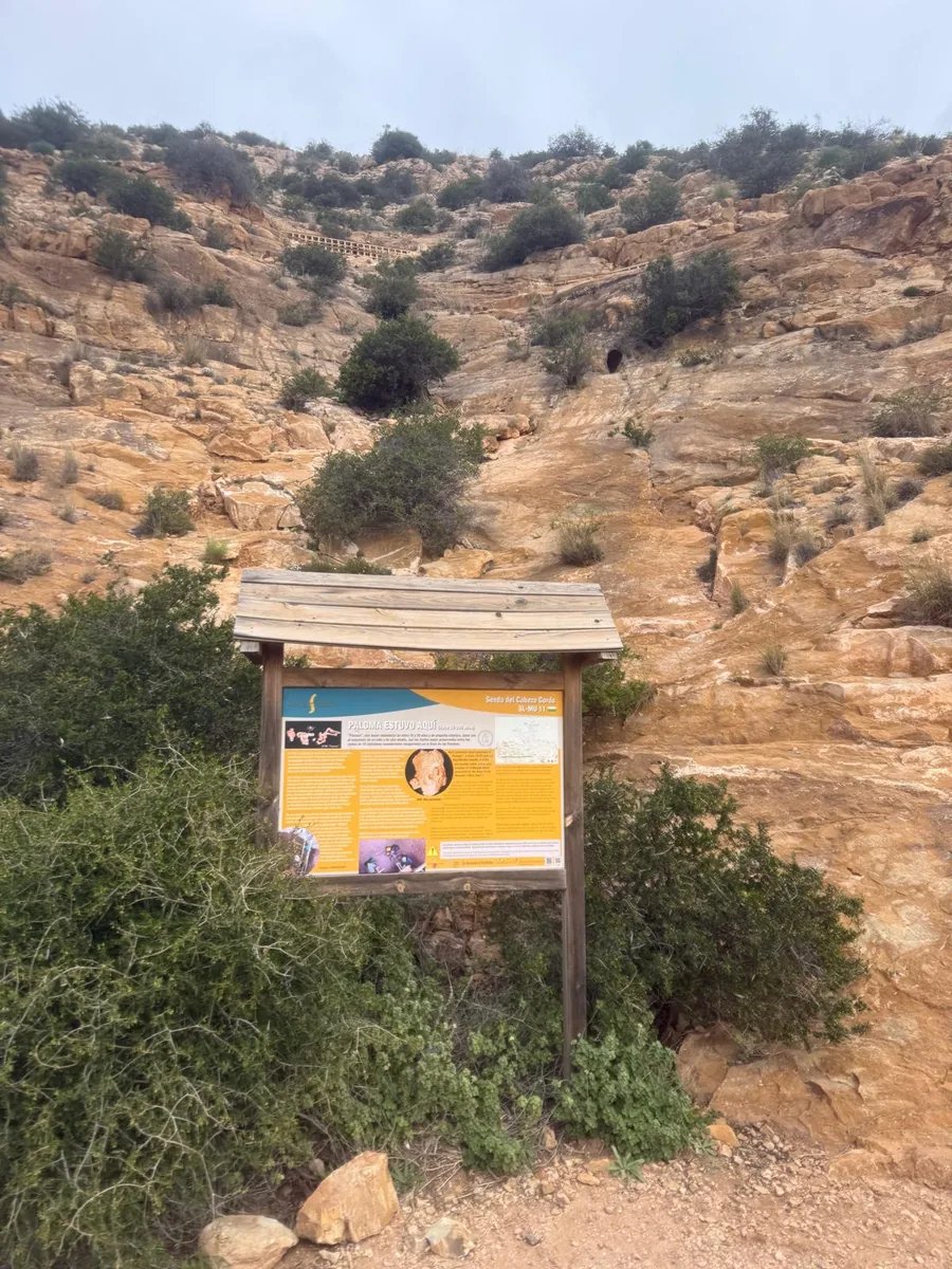
Along the hiking path stands an information board with the title ‘Paloma estuvo aquí’: Paloma was here. The board tells the story of the Neanderthal woman who was found here. The site itself is closed off and can only be entered during organised visits (see practical information).
Our own experience at Cabezo Gordo
We explored Cabezo Gordo ourselves by mountain bike. We cycled there from the Lo Pagán area and rode a loop through the area. What stayed with us most: how quickly the landscape changes. Down below you cycle through flat land with fields and greenhouses; a little later you are riding on a rocky path with wooden railings, between red rock faces and low vegetation.
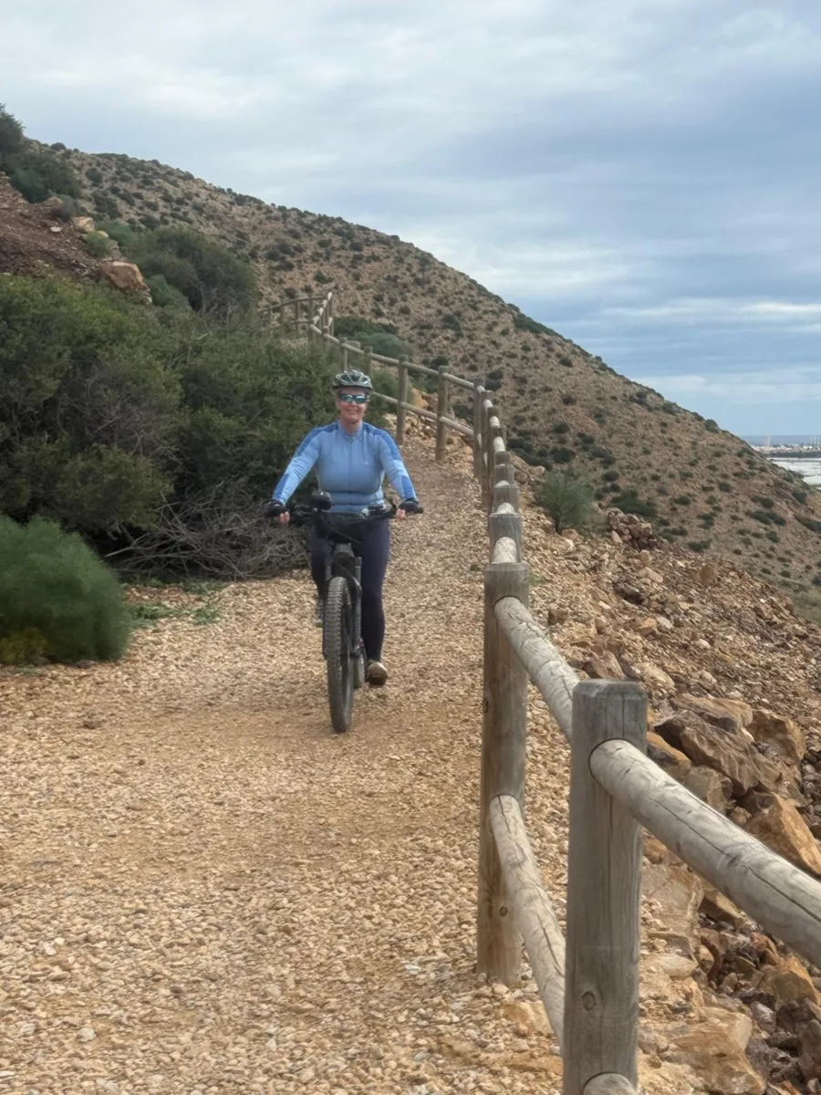
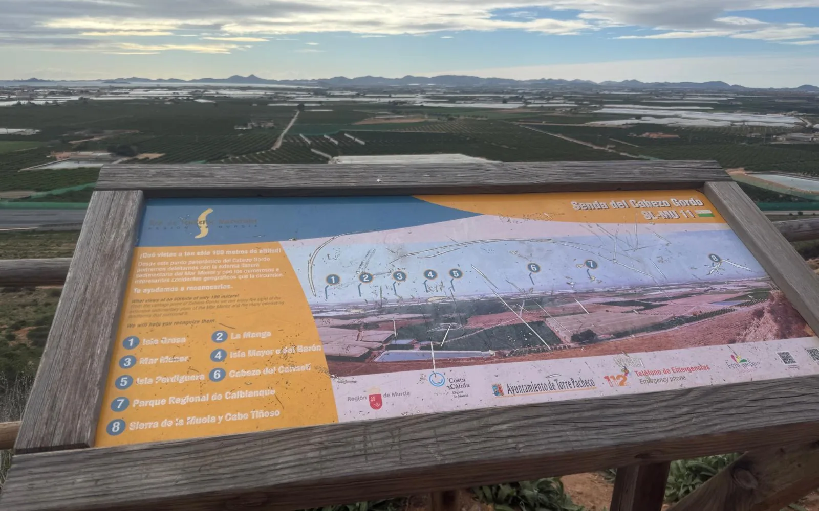
The highlight is the viewpoint with an information board of the Senda del Cabezo Gordo. The board proudly announces: ‘¡Qué vistas a tan sólo 100 metros de altitud!’, what a view at only 100 metres altitude. It points out what you can see on a clear day: Isla Grosa, La Manga, the Mar Menor with the islands Isla Mayor (or del Barón) and Isla Perdiguera, the Cabezo del Carmolí, the Parque Regional de Calblanque and the Sierra de la Muela and Cabo Tiñoso. Exactly the view in the photo at the top of this article.
Mountain biking at Cabezo Gordo
Our ride was our own route, not an officially waymarked MTB route. As far as we know, there is no official mountain bike route on Cabezo Gordo; the waymarked Senda del Cabezo Gordo is a footpath.
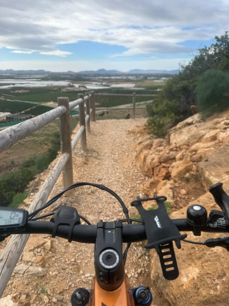
If you cycle here, keep the following in mind:
- The paths are partly loose gravel and rocky, and on narrow sections with railings you will meet walkers. Give way to them.
- Cabezo Gordo is a protected landscape. Stay on the existing paths and follow the signs on site.
- Take enough water with you and wear a helmet.
For those who live near the Mar Menor, Cabezo Gordo is a great destination for a bike ride inland: we rode there ourselves from the Lo Pagán area.
Hiking at Cabezo Gordo
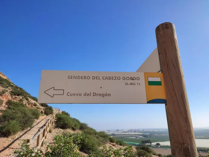
The Senda del Cabezo Gordo (SL-MU 11), a waymarked local footpath, runs across the mountain. The information boards bear the logo of the network of nature trails of the Murcia region and of the municipality of Torre-Pacheco. They stand at, among other places, the viewpoint and the site where Paloma was found. A signpost along the path also points to the Cueva del Dragón.
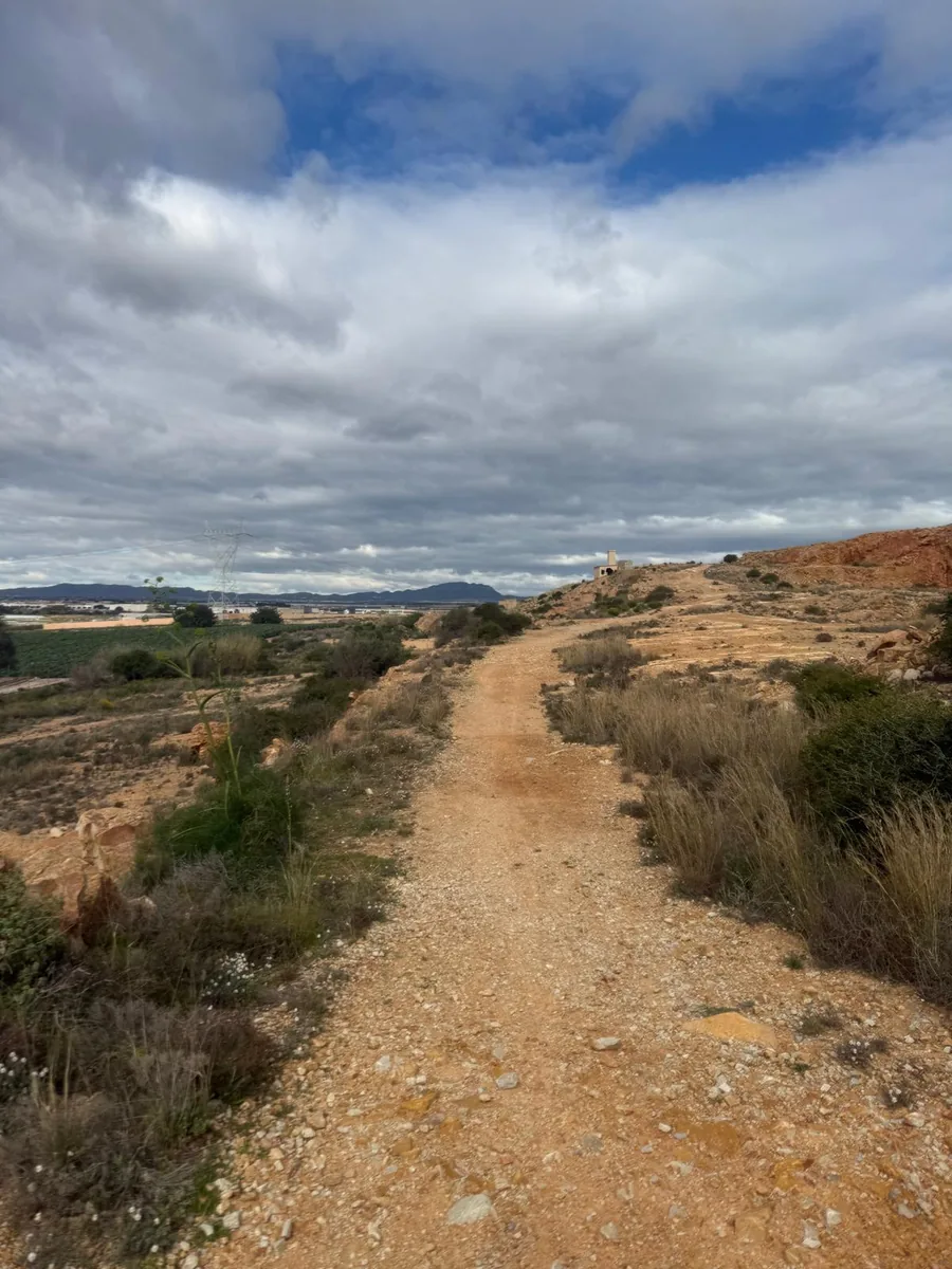
Would you like to follow the hiking route exactly, with a map and elevation profile? Then take a look at this route on Wikiloc: Cabezo Gordo (Torre-Pacheco) on Wikiloc. Check the current distance and elevation gain there before you set off.
Practical information for a visit
- Sima de las Palomas and Cueva del Agua: can only be visited during guided visits that the municipality of Torre-Pacheco organises periodically. The Cueva del Agua is an old mine with a natural freshwater lake, home to bats. Registration is via Murcia Turística. Dates and conditions: Torre-Pacheco tourist office, turismo@torrepacheco.es or 968 579 937.
- What to bring: Turismo Región de Murcia recommends good shoes, water, sun protection and a cap. For a visit to a cave or mine gallery, a torch is essential.
- Little shade: the path is largely exposed. In hot weather, set off early.
- Protected area: stay on the paths and leave plants, animals and rocks undisturbed.
AnaCosta tip
Combine a morning on Cabezo Gordo with an afternoon on the Mar Menor. From the viewpoint you can already see the lagoon; afterwards you can drive there for lunch by the water.
What else is there to do in the area?
Cabezo Gordo is not in Lo Pagán, Santiago de la Ribera or Los Alcázares. For those who live in or are staying in one of those places on the Mar Menor, however, the mountain makes a great excursion inland. Read more about the area:
- The beaches of the Mar Menor & La Manga
- Las Salinas of San Pedro del Pinatar: walking along salt lakes and flamingos
- The mud baths of Lo Pagán
- Golf on the Costa Cálida
- Buying a property in Lo Pagán · Santiago de la Ribera · Los Alcázares · San Pedro del Pinatar
Living in this area?
Cabezo Gordo lies in the municipality of Torre-Pacheco. Roldán is also in this municipality: an inland village, with the Mar Menor and several golf courses in the area. Near Roldán there is also the separate golf resort La Torre Golf. Would you like to know what it is like to live here, and which homes are currently for sale? Then read our guide to buying property in Roldán.
Sources
- Turismo Región de Murcia: Cabezo Gordo (natural area)
- Turismo Región de Murcia: Ruta Cabezo Gordo
- Ayuntamiento de Torre-Pacheco: visiting the Sima de las Palomas
- Ayuntamiento de Torre-Pacheco: visits to Cabezo Gordo and Cueva del Agua
- Walker et al. (2008), PNAS: Late Neandertals in Southeastern Iberia
- Walker et al. (2010), American Journal of Physical Anthropology: Neandertal mandibles
- Walker et al. (2011), American Journal of Physical Anthropology: Neandertal postcranial remains
- Walker et al. (2011), PNAS: female Neandertal from the Sima de las Palomas
Living around the Mar Menor or in Torre-Pacheco?
Would you like to live close to nature such as Cabezo Gordo, with the Mar Menor and the golf courses within reach? AnaCosta searches independently, on your side, for the home that suits you.
A property in Spain? Do it smarter.
AnaCosta Property Finders
The Smarter Way to Spain
Costa Blanca · Costa Cálida · Costa de Almería